Randonnée Marche La Chapelle-Gauthier - Boucle des Gauthiers - La Chapelle Gauthier - Photo

Boucle des Gauthiers - La Chapelle Gauthier

 tracegps
tracegps

Utilisateur

© OpenStreetMap contributors
Longueur
Longueur
15,9 km
Altitude max
Altitude max
201 m
Dénivelé positif
Dénivelé positif
122 m
Km-Effort
Km-Effort  
17,6 km
Altitude min
Altitude min
134 m
Dénivelé négatif
Dénivelé négatif
121 m
Boucle
Boucle
Oui
Date de création :
2014-12-11 00:00:00.0
Dernière modification :
2014-12-11 00:00:00.0

(0 Avis)

Marche
Marche
1h00
Difficulté : Moyen

Scannez ce code QR pour ouvrir la randonnée dans l'application SityTrail

Application GPS de randonnée GRATUITE

Logo SityTrail SityTrail

IGN / Instituts géographiques

Télécharger SityTrail sur l'App Store Télécharger SityTrail sur Google Play

Logo SityTrail SityTrail World

Le monde est à vous

Télécharger SityTrail sur l'App Store Télécharger SityTrail sur Google Play Télécharger SityTrail sur Huawei AppGallery

À propos

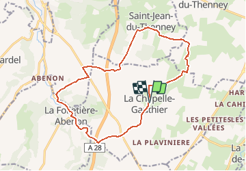
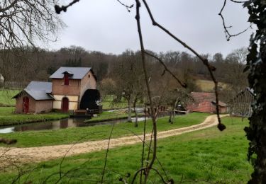
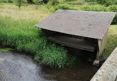
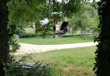
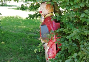
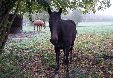
Randonnée Marche de 15,9 km à découvrir à Normandie, Eure, La Chapelle-Gauthier. Cette randonnée est proposée par tracegps.

Description

Circuit proposé par la Communauté de Communes du canton de Broglie. Départ de la mairie de La Chapelle-Gauthier. Ce circuit a été numérisé par les randonneurs du CODEPEM. Merci à Jean-Marie.

Profil altimétrique

Localisation

Pays :
France
Région :
Normandie
Département/Province :
Eure
Commune :
La Chapelle-Gauthier
Localité :
Unknown
Départ:(Dec)
Départ:(UTM)
314368 ; 5429094 (31U) N.

Randonnées à proximité

Randonnée Marche La Chapelle-Gauthier - La Mare Péreuse - La Chapelle-Gauthier - Photo
Marche
tracegps

Marche

Moyen
La Chapelle-Gauthier, Normandie, Eure, France
10,3 km | 11,9 km-effort
2h 45min
Oui
Randonnée Vélo Broglie - Boucle des 3 Maréchaux  -  Broglie - Photo
Vélo
tracegps

Vélo

Moyen
Broglie, Normandie, Eure, France
18,5 km | 20 km-effort
1h 15min
Oui
Randonnée Marche Broglie - Circuit du Prieuré - Broglie - Photo
Marche
tracegps

Marche

Difficile
(1)
Broglie, Normandie, Eure, France
13,2 km | 14,9 km-effort
3h 19min
Oui
Randonnée Marche Saint-Aubin-du-Thenney - boucle de St Aubin  - Photo
Marche
ymarvin

Marche

Facile
Saint-Aubin-du-Thenney, Normandie, Eure, France
5,2 km | 5,7 km-effort
1h 1min
Oui
Randonnée Marche Broglie - Broglie - Photo
Marche
werth

Marche

Moyen
Broglie, Normandie, Eure, France
10,1 km | 11,8 km-effort
2h 50min
Oui
Randonnée Marche La Trinité-de-Réville - la trinite de Reville  - Photo
Marche
ymarvin

Marche

Moyen
La Trinité-de-Réville, Normandie, Eure, France
9,8 km | 12 km-effort
2h 3min
Oui
Randonnée Marche Broglie - autour de Broglie - Photo
Marche
ymarvin

Marche

Très facile
Broglie, Normandie, Eure, France
8,6 km | 9,6 km-effort
1h 45min
Oui
Randonnée Marche Saint-Aubin-du-Thenney - Saint aubin du thenney - Photo
Marche
ymarvin

Marche

Très facile
Saint-Aubin-du-Thenney, Normandie, Eure, France
7,8 km | 8,6 km-effort
1h 42min
Oui
Randonnée Marche La Vespière-Friardel - La Vespiere  - Photo
Marche
Eve - Line

Marche

Moyen
La Vespière-Friardel, Normandie, Calvados, France
22 km | 27 km-effort
4h 22min
Oui


Fermer
Mes abonnements